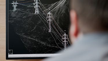
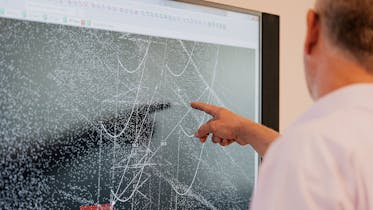
Swissgrid has recorded all the power lines in the transmission grid in a new, digital 3D model. This model makes precise information on the systems and their environment available from office desks at the click of a mouse. The employees at the individual bases, such as engineers, project managers or plant managers, all have access to the same database. This makes it much easier to share information or plan upcoming work, whether it be new work or renovations, maintenance, or the regular trimming of vegetation that grows around the lines.
The 3D data allows for a more detailed analysis of possible risks, such as trees that could grow into the lines. Where a maintenance manager or forester previously had to go to the site to determine the measures needed for cutting back the vegetation, initial analyses can now be made from the office desk. In hard-to-reach areas in particular, it is difficult to assess and record the vegetation in the safety area of a power line. Furthermore, lines stretch and hang lower when temperatures rise, which increases the risk of electric flashovers. Today, such risks can be identified through detailed simulations and appropriate measures taken.
Date collection by helicopter
As part of the route digitisation project, Swissgrid used digital aerial photography and state-of-the-art scanning technology to three-dimensionally record all the lines and substations on the transmission grid in 2018. This provides up-to-date, consistent documentation of all the objects within a 200-metre-wide corridor along the power lines. A three-dimensional model of the power lines was ultimately created from the vast quantity of data, which is now used as documentation and for line calculations, analyses and simulations.


